Bushfire recovery in endangered dry sclerophyll woodlands
Funding period: 2020-2023
Funding agency: Wildlife and Habitat Bushfire Recovery Program, Department of Agriculture Water and Environment
Project leader, researchers and collaborators: Project leaders, researchers and collaborators: Elise Pendall (Lead), Matthias Boer, Yolima Carrillo, Steve Chapple, Tony Gray, Alison Hewitt, Inna Ljungblom, Jason Middleton, Peter Mobbs, Peter Mumford, Vera Odonovan, Peter Ridgeway, Paul Rymer, M Sherring, Greg Steenbeeke, Stephen Wright
Project description: The aim of the project is to assess impacts and facilitate recovery from bushfires in threatened ecological communities of Western Sydney, using remote sensing and onground surveys. Changes in vegetation structure has been documented as well as canopy condition (scorch, resprouting) seed abundance, endangered plant species, and weed invasion in burned and unburned fragments of Castlereagh Scribbly Gum and Agnes Banks Woodland, Shale Sandstone Transition Forest, and Cooks River/Castlereagh Ironbark Forest. Seed collection will target threatened species. New knowledge about vegetation structure and biodiversity will inform use of future managed burns. Western Sydney University will lead the project and partner with Deerubbin LALC, GS-LLS, UNSW, DPIE and NPWS.
Publications: Pendall, E., Hewitt, A., Boer, M. M., Carrillo, Y., Glenn, N. F., Griebel, A., Middleton, J. H., Mumford, P. J., Ridgeway, P., Rymer, P. D., & Steenbeeke, G. L. (2022). Remarkable Resilience of Forest Structure and Biodiversity Following Fire in the Peri-Urban Bushland of Sydney, Australia. Climate, 10(22). https://doi.org/10.3390/cli10060086

Abstract: In rapidly urbanizing areas, natural vegetation becomes fragmented, making conservation planning challenging, particularly as climate change accelerates fire risk. We studied urban forest fragments in two threatened eucalypt-dominated (scribbly gum woodland, SGW, and ironbark
forest, IF) communities across ~2000 ha near Sydney, Australia, to evaluate effects of fire frequency (0–4 in last 25 years) and time since fire (0.5 to >25 years) on canopy structure, habitat quality and biodiversity (e.g., species richness). Airborne lidar was used to assess canopy height and density, and ground-based surveys of 148 (400 m2) plots measured leaf area index (LAI), plant species composition and habitat metrics such as litter cover and hollow-bearing trees. LAI, canopy density, litter, and microbiotic soil crust increased with time since fire in both communities, while tree and mistletoe cover increased in IF. Unexpectedly, plant species richness increased with fire frequency, owing to increased shrub richness which offset decreased tree richness in both communities. These findings indicate biodiversity and canopy structure are generally resilient to a range of times since fire and fire frequencies across this study area. Nevertheless, reduced arboreal habitat quality and subtle shifts in community composition of resprouters and obligate seeders signal early concern for a scenario of increasing fire frequency under climate change. Ongoing assessment of fire responses is needed to ensure that biodiversity, canopy structure and ecosystem function are maintained in the remaining
fragments of urban forests under future climate change which will likely drive hotter and more frequent fires.
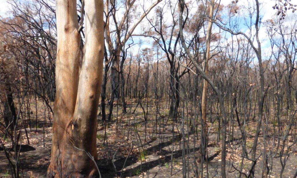
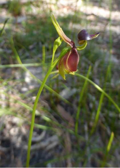
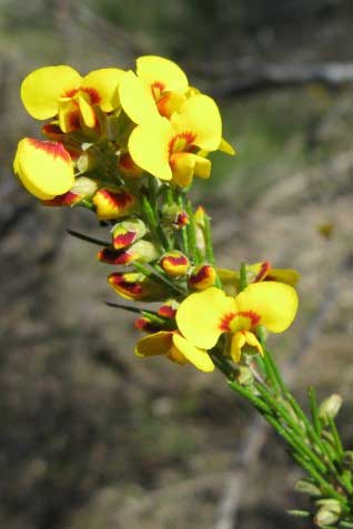
Presentation of the project from the HIE Research Symposium, Western Sydney University, the 12th of May 2021.
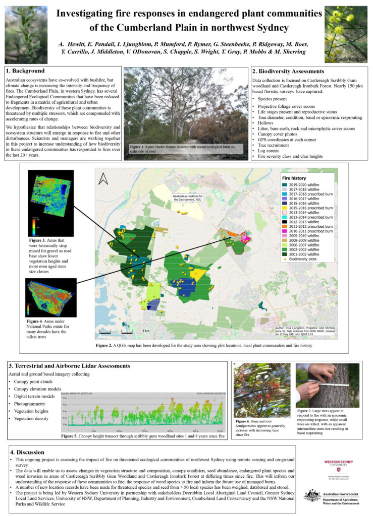
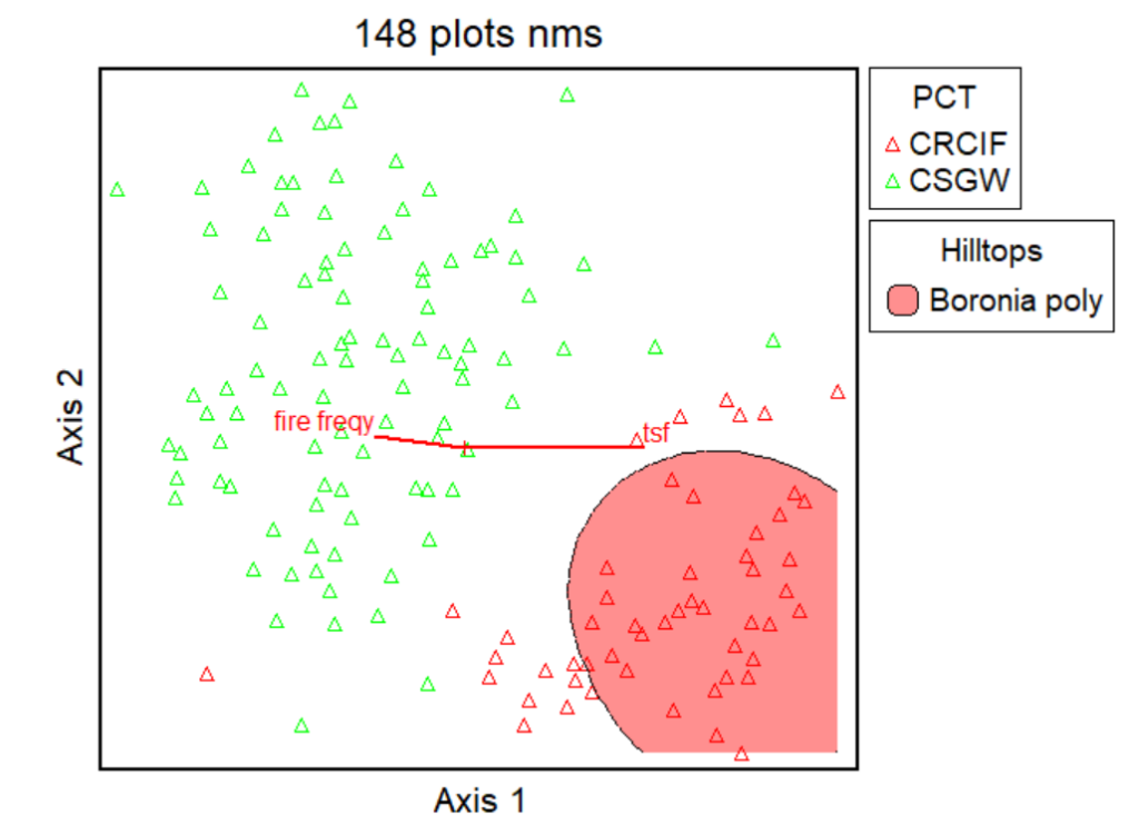
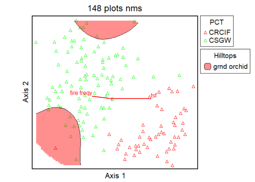

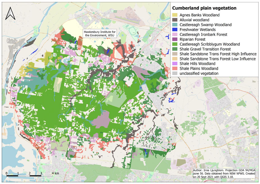
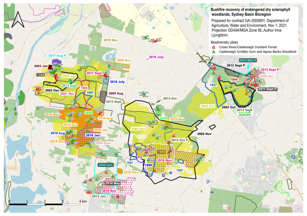
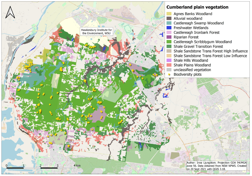
Please see maps for vegetation and fire history below. Click on the maps to get them in higher resolution.
There is also a QGIS Cloud map with those layers. To get access contact Elise Pendall at HIE. More information about the files here >>
Species sighting data (on ground survey data) is uploaded to NSW BioNet. NSW BioNet is the repository for biodiversity data products managed by the Department of Planning, Industry and Environment. BioNet aims to improve biodiversity outcomes by enabling the community and government to proactively manage and enhance biodiversity in NSW through comprehensive, credible and robust data and information.
Files used in the project are available in the Cumberland Plain folder in CloudStor.
Click on the pictures below for higher resolution.
Survey area. Click on map for higher resolution.
Cumberland Plain Vegetation. Click on map for higher resolution.
Sources for fire layers: RFS, NSW NPWS or captured from NearMaps.
Sources for fire layers: RFS, NSW NPWS or captured from NearMaps.
Cumberland Plain Vegetation and Survey Plots. Click on map for higher resolution.
Biodiversity plots. Click on map for higher resolution.

